
Club History In Photos: 1957-1979
Thanks to Charlie Webster and Dr. Nathan Arenson, a large collection of photos from our club's past became available and sharing with everyone seemed like the best thing that could be done with them. Our hope is that while you enjoy the photos, you may see something or someone you recognize.
If you can help us pin point a date or year, see something or someone familiar, please share with us to complete the "picture", please feel free to send that information in an email to the editor at newsletter@pensacolarifleandpistolclub.com
Rifle Matches on the Ft. Pickens Military Base.
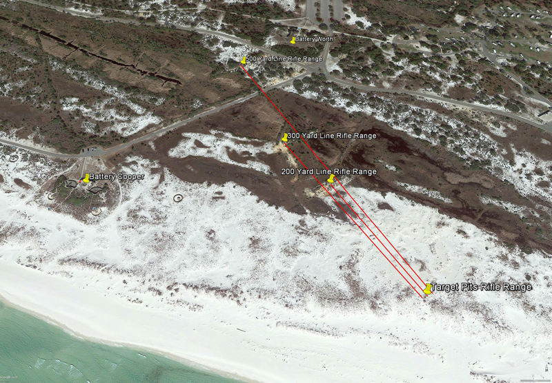
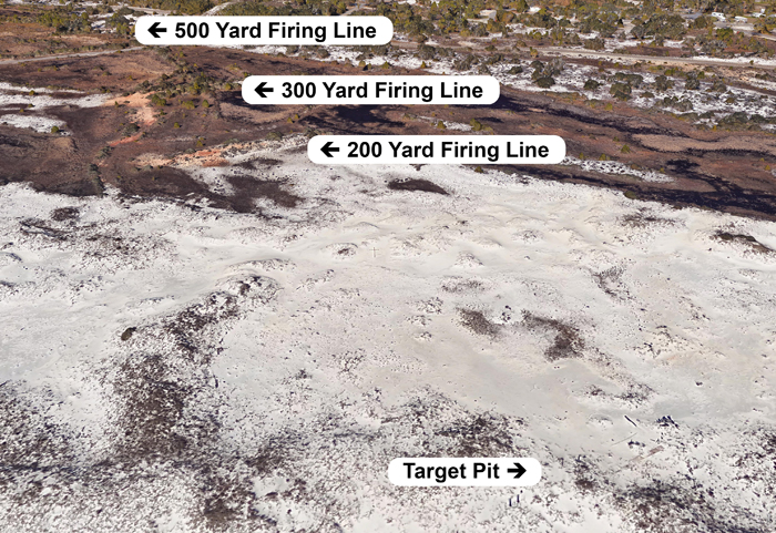
Location Evidence Using Google Earth Imagery and Measuring tools.
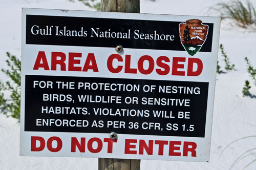
The rifle range at Ft. Pickens was at 500 yard known distance range (KD). It had a target pit area with protection wall which was covered in sand, a 200, 300 and 500 yard line built up and stabilized with red clay and timber. Only the 500 yard line is easy to see today since the rest is surrounded by signs and fencing not allowing entrance for bird nesting in that area.
Satellite photos allow one to see the red clay in apparent lines that fall parallel with each other. Where else would the clay have come from but the army building a project.
The first photo shows the range using Google Earth and using it to measure the distance in yards from the ruins of the pit to the firing lines. Many KD ranges today extend to 600 yards, but at that time many military ranges would extend only to 500 yards if pressed for space or other needs.
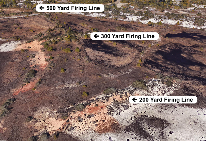
The next two photos show a closer to the ground view. While skewed in perspective, they show more detail.
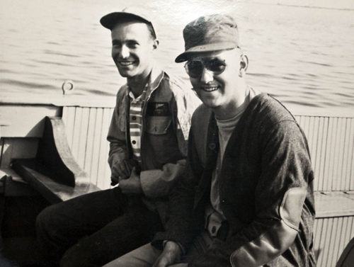
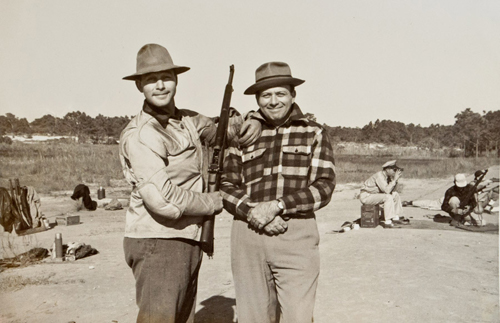
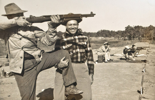
The Rifle Matches
These photos are dated November 17, 1950
Our photo collections include a match from the 1950s where club members Bobby Kahn and Nat Arenson were attending. It is quite possible that the M1 Garands they are using in the photos were rifles issued at the match along with issued ammuntion as part of the Department of Civilian Marksmanship.
It has been passed down that competitors had to go by boat to the get the range beginning from the Naval Air Station Pensacola.
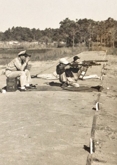
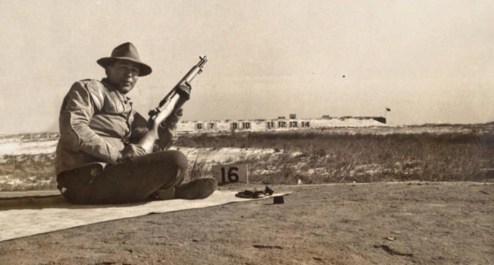
(note: the bolt is open, he is not shooting on one leg)
The Remnants of the Rifle Range at Ft. Pickens on Santa Rosa Island.
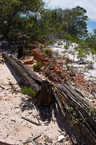
There is not much left of the range, the pit wall existed until Hurrican Ivan destroyed all but a few pilings that are still standing. Before Ivan, one would walk along the beach and marvel at the wooden wall built just at the edge of the dunes.
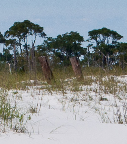
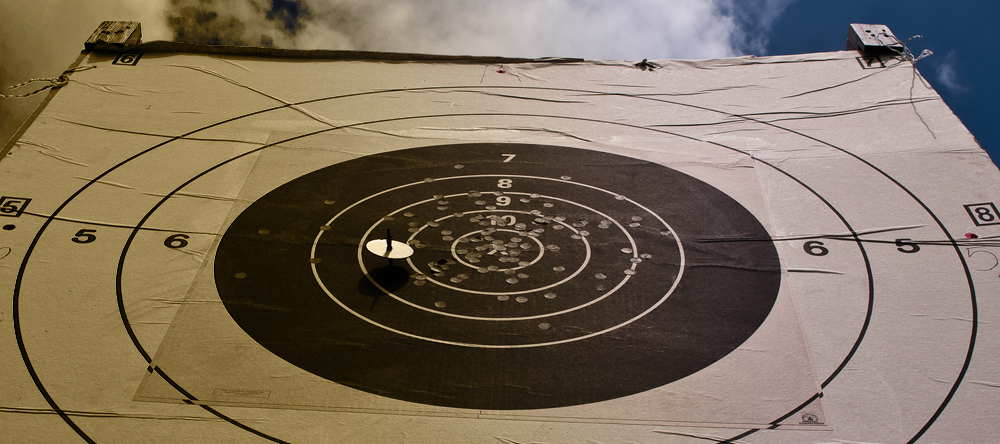
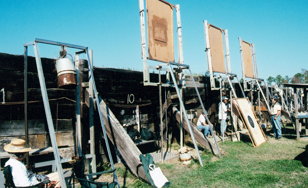
The Ft. Pickens target pit wall had a similar design to the range in this photo. It's close enough to make the comparison to what was once at Ft. Pickens. The large target numbers seen in the photo of Bobby Kahn on the rifle range would be on the other side of the wall, along with a large pile of sand that protected the people scoring the targets behind the wall in the pit.
The 200 and 300 Yard Line Remnants.
The 200 and 300 yard lines are not readily accessible due to the National Park Service closing the area for bird nesting. However the 500 yard line can be explored. It's almost in the shadow of Battery Worth, which most likely have been range control until the base was deactivated.
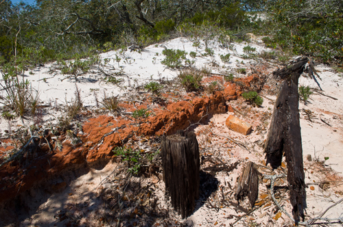
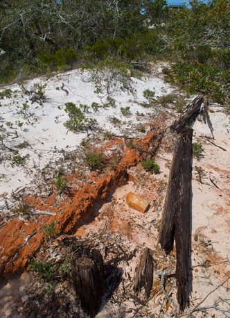
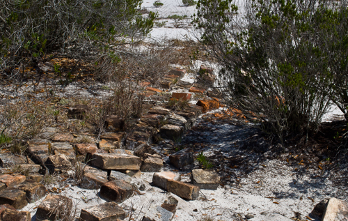
The 500 Yard Line Remnants.
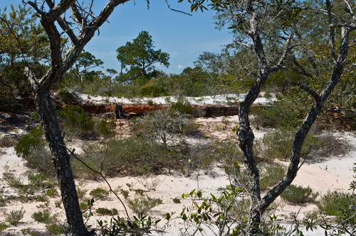
Using the Google map images, the 500 yard line was found hidden several yards away from the road that leads out of Battery Cooper. It lies in view the control tower of Battery Worth which can be seen in one of the photos. The red clay firing line is still held back by wood supports. There is evidence of a brick road behind the firing line as well.
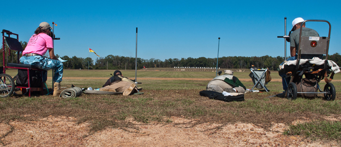
This photo is from a high power rifle match during the 600 yard stage. The Ft. Pickens range was 500 yards, so this is pretty close to that distance to show perspective. The rifles have changed, but the fundamentals remain the same.